Sundarbans is cyclone capital of India: IMD
West Bengal’s South 24 Parganas district, within which the larger share of the Sundarbans is located, is impacted by cyclones the most frequently among Indian districts, found a recent study.
Context
West Bengal’s South 24 Parganas district, within which the larger share of the Sundarbans is located, is impacted by cyclones the most frequently among Indian districts, found a recent study.
About Sundarbans
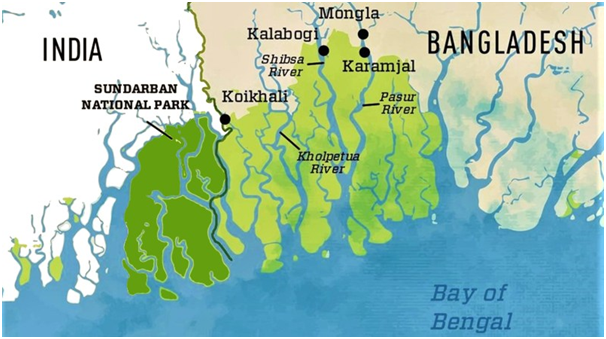
- The Sunderbans forest sprawls over 10,000 sq km covering India and neighbouring Bangladesh, of which 40% lies in India.
- It is located in the south-west of Bangladesh between the river Baleswar in the East and the Harinbanga in the West, adjoining to the Bay of Bengal.
- In India, it is confined to the southern tip of West Bengal and spreads over two districts – South 24 Parganas and North 24 Parganas.
- The Sundarban Delta has 102 islands, of which 54 are inhabited. The rest constitute the world’s largest mangrove forest.
- Sundarbans has got the world’s largest coastal mangrove forest (an area of about 10,000 km2, shared between India (4,000 km2) and Bangladesh (6,000 km2).
- The Sundarbans is a UNESCO world heritage site and a critical wetland.

The reduced forest cover
- The State of Forest Report 2021 revealed that the very dense mangrove cover in the Sunderbans shrank by two square kilometres – from 996 sq km to 994 sq km - between 2019 and 2021.
- The delta had a dense mangrove cover of 999 sq km in 2017, which declined by 3 sq km in 2019.
- The southern Bengal delta was hit by two very severe cyclones – Amphan in May 2020 and Yaas in May 2021 – which took a toll on the vegetation. Nearly one-third of the delta was severely damaged during Amphan.
Tropical Cyclone
|

